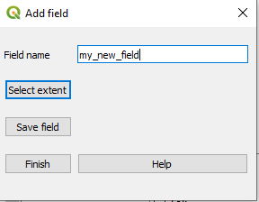
There are three ways that you can add fields, they are all present on 🚜 Farm & Fields. To manually add a field and click on Add field manually. Fill in the name of the field and then press on Select extent.
Now you need to navigate to your QGIS window, start with zooming into your field. (To zoom you can simply scroll with the mouse and it will zoom in/out depending on where your mouse is located.) In the QGIS window you may also see:
that my_new_field has been added as a layer in the layer list.
that the edit button is enabled.
that add new Polygon is enabled.
left click on a corner of your field, then you will see that a thin red line will follow your mouse, then left click on the new corner and so on.
When you have found all edges right click anywhere on the QGIS window.
Then you need to find the Add field window and press Save field to continue with adding more field or Finish if you don’t want to add any more field.